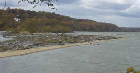
The
rubble remains of the first of seven dams
that watered the canal. (CM High photo)
|
Added
to Mile 5.6 in the Updated Edition:
Some
of the best kayakers in the U.S. take advantage of the temperate weather
to train here year-round, as well as at the warm-water chute at the
Dickerson Power Plant (see mile 40.6). This was the upper end of the
skirting canal built around Little Falls by the Patowmack Company
from 1785-1795. (Washington's diary indicated that a channel still
remained from Ballendine's early canal project in 1774-1775.) This
is also where President John Quincy Adams broke the first ground for
the C&O Canal on July 4, 1828. At the time the Company only planned
to extend the Little Falls canal upstream, letting boats enter and
exit the canal just below the falls.
|
To be added
Mile
5.6:
According
to the Washington Post, this occasion was the first time that
the Marine band played "Hail to the Chief."
Mile
7:
The
National Intelligencer reported that on May 29, 1829, the cornerstone
was laid for the "first lock" on the Chesapeake and Ohio
Canal, "about 7 miles above Georgetown." This was likely
Lock #7, the first lock above Dam #1, where President John Quincy
Adams had stuck the first spade into earth the previous summer. (Locks
1-6 in Georgetown and along the route of the skirting canal were likely
begun later.) The new President, Andrew Jackson, was on hand to make
a few comments, which were not recorded for posterity. And of course
the Marine Band and the Masonic Brotherhood were out in full force.
The President of the canal company, Charles Fenton Mercer, no friend
of Jackson?s, sent his regrets, saying that he was busy preparing
the first annual report to stockholders.
|
Documents
Diary
entry by President John Quincy Adams,
for July 4, 1828:
July
4.--Independence Day. Chesapeake and Ohio Canal commenced. Between
seven and eight this morning I went with my son John to the Union
Hotel, at Georgetown, where were assembled the President and Directors
of the Chesapeake and Ohio Canal Company; the Mayors and Committees
of the corporations of Washington, Georgetown and Alexandria; the
heads of Departments, foreign Ministers, and a few other invited persons.
About eight o'clock a procesion was formed, preceded by a band of
music, to the wharf, where we embarked on the steamboat Surprise;
followed by two others, we proceeded to the entrance of the Potomac
Canal, and up that in canal-boats to its head -- near which, just
within the bounds of the State of Maryland, was the spot selected
for breaking the ground.
The
President of the Chesapeake and Ohio Canal Company, with a very short
address, delivered to me the spade, with which I broke the ground,
addressing the surrounding audience, consisting perhaps of two thousand
persons. It happened that at the first stroke of the spade it met
immediately under the surface the large stump of a tree; after repeating
the stroke three or four times without making any impression, I threw
off my coat, and resuming the spade, raised a shovelful of the earth,
at which a general shout burst forth from the surrounding multitude,
and I completed my address, which occupied about fifteen minutes...
|
|
Additional
Notes and Sources:
- See
the The Diaries of George Washington. Vol. 4. Donald Jackson,
and Dorothy Twohig, eds. The Papers of George Washington. Charlottesville:
University Press of Virginia, 1978, which are available on the Web
as a part of the George
Washington Papers at the Library of Congress. Washington's diary
entry of September 22, 1785 describes the land around Little Falls
and refers to the earlier canal project of John Ballendine.
- Ballendine's
"scheme" is discussed in Early Chapters in the Development
of the Patomac Route to the West, by Mrs. Corra Bacon-Foster,
1912, pages 24-30.
- See
"John Ballendine's Eighteenth Century Map of Virginia,"
an article by Arthur G. Burton and Richard W. Stephenson appearing
in A La Carte: Selected Papers on Maps and Atlases, compiled
by Walter W. Ristow of Geography and Maps Division of the Library
of Congress, and published by the Library in 1972. This highly informative
article ranges far beyond Ballendine's map to discuss his life and
work, including his plans to develop the Potomac and James Rivers
for navigation.
- The
Memoirs of John Quincy Adams, Comprising Portions of His Diary from
1795 to 1848, as transcribed by Charles Francis Adams, published
1874-1877, Philadelphia, Pennsylvania. [See
Volume 8 for July 4, 1828 entry--also
included in a subsequent single-volume selection edited by Allan Nevins.]
|
