Notes on Point of Rocks & The Potomac Iron Company
Reference in C&O Canal Companion: Mile 48.2
|
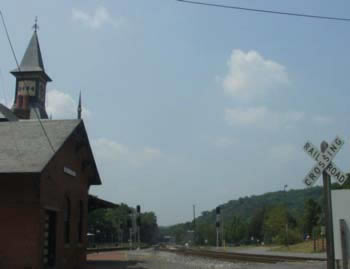
The
Victorian-style train station at Point of Rocks, with the
|
|
To be addedMile 48.2: Another notable owner (1853-1859) was Colonel John Geary, who was also briefly the governor of the territory of Kansas during that period (1856). Geary was quickly worn down and grandly disillusioned by the experience of keeping the Kansas slaveholders and John Brown and the abolitionist settlers from massacring one another. His furnace venture didn't go so well either -- he sold the property in 1859. However, that wasn't the end of his adventures on the Potomac. He reappears in our story at Sandy Hook (see Mile 59.5) in 1861. *** Originally, the railroad line only ran to Baltimore from Point of Rocks. In 1859, when Robert E. Lee came up from Washington to capture John Brown, he had to come the long way around, going up nearly to Baltimore before heading west, to get to the Potomac and Harpers Ferry. After the Civil War, faced with increasing competition from other railroads, the B&O decided it needed to have a direct connection to the capital. It acquired the rights to the Metropolitan Railroad, a struggling venture founded by Washington businessmen, and began building in 1866 at Barnesville. It took a surprisingly long time to build this short connector, which finally opened in 1873, but it immediately took a large share of the passenger and mail traffic from the Baltimore route. Part of this construction was the distinctive Victorian railroad station that sits in the "wye" where the two routes go their separate ways. At the outbreak of the Civil War, the B&O RR stationmaster was Noble Means. Despite the fact that his brother was Samuel Means, a lapsed Quaker who organized the Loudoun Union Cavalry, Noble Means was briefly imprisoned on suspicions of maintaining communications with the secessionists. Given the litany of ambushes and retreats under Samuel Means' command early in the war, some Unionists might have preferred to imprison him. No year of the Civil War was complete without some action at Point of Rocks, usually involving the B&O Railroad as a target. In early May, Colonel T.J. Jackson (later "Stonewall") had aggressively stationed Captain Turner Ashby's men on the Maryland side of the Point of Rocks bridge. It was probably a good place to put Ashby, who was something of an independent operator and was annoyed by Jackson's decision to put the younger J.E.B. Stuart in charge of the cavalry at Harper's Ferry. Looking to the future, the Confederates mined the bridge piers so that it could be destroyed in the event Ashby was forced back to the Virginia side of the river. When Robert E. Lee learned what Jackson was doing, he sent a diplomatic message warning about antagonizing their neighbors in Maryland, concluding "I presume the points occupied by you at Point of Rocks, Berlin, and Shepherdstown are on our side." Significantly, Lee did not ask Jackson to confirm his assumption or to treat it as an order. Thus, Jackson was able to continue a limited campaign of inspecting and sometimes interrupting canal and railroad traffic in Maryland, taking the opportunity to seize livestock and horses, and even a Union general. When Virginians voted to secede from the Union on May 23rd, Jackson was apparently emboldened, and by the 27th the C&O Canal Company's president, Alfred Spates, observed that Ashby's men had succeeding in blasting enough rock off the cliffs at Point of Rocks to completely block the railroad and threaten canal navigation. (Spates had gone up to Harpers Ferry to negotiate with Jackson to allow the passage of canal boats.) By the end of July the Confederates were back in Virginia, the bridge was gone, and units of the 28th Pennsylvania Regiment were arriving to occupy the town and eventually establish a picketing force on "Heter's" (Heaters) Island. On December 19, 1861, Lieutenant Colonel Gabriel De Korponay reported that the Confederates had pulled two "brass-mounted" pieces to the top of Furnace Mountain and begun to shell the Maryland side, supported by about 150 infantry hiding in the furnace buildings across the river. According to De Korponay's account, which seems to have been influenced by his superior's hyberbolic style, the very first return shot from his battery knocked out one of the cannon on the mountain. While he wasn't sure of the number of casualties his men had inflicted, he was "satisfied that it was considerable." That winter, the men at "Camp De Korponay" moved up into the shelter of the trees on higher ground and set about building some log cabins. After the Pennsylvanians moved on to action further south, Point of Rocks became more vulnerable to cavalry raids. During the Maryland invasion next September 7th, Captain Russell led 50 men of the First Maryland Cavalry (a Union outfit) on a reconnaissance that included a skirmish with Confederate troops crossing at Point of Rocks. According to the report of his superior, Colonel Thomas Ford, Russell's men killed three Confederates and captured 17, a signal success given the situation. On the night of the 12th, as Union forces were retaking Point of Rocks, Lieutenant Fralick of the signal corps had reached the ridge above the town to establish communications with the station on Sugarloaf Mountain. His attempts to signal the embattled Union contingent on Maryland Heights by firing rockets and "red lights" were unsuccessful, because the signal officer on the Heights had already removed himself. In the ensuing inquiry concerning the surrender of Harper's Ferry, the chief signal officer simply stated that the other Lieutenant had "so far misapprehended the position in which he could be of most service as to leave the Heights prior to their investment." On June 18, 1863, at the outset of the campaign that led to Gettysburg, Colonel Elijah White asked for permission to detach himself from main Confederate body in the Shenandoah Valley for a quick visit to his old haunts. His men crossed the Potomac about three miles above Point of Rocks and took five companies on a mad dash down the towpath into the town. He cut the telegraph wires, seized and burned a B&O train, and caused President Garrett of the B&O Railroad to pass on a panicky report from the telegraph operator that the raiders had carried off "Captain Means and his entire company of cavalry." Another company of White's men proceeded down the "Frederick road," where they met and drove off Colonel Cole's company of Union cavalry near the mouth of Catoctin Creek. White's companies then rejoined the main body of the Lee's army, where their services were urgently needed in the absence of J.E.B. Stuart's cavalry, who were still roaming around Northern Virginia (see Mile 22). On July 4, 1864, Mosby revisited the town in what some termed "The Calico Raid," in a successful diversion during Jubal Early's movement around Harper's Ferry and towards Washington. The Confederate raiders found that the retreating Union troops had torn up the planking on the bridge across the canal, so they set about repairing it with lumber from one of the adjacent buildings. Once across the canal, they stacked logs across the railroad track and drove off a B&O train, cut the telegraph wires, and looted several stores. Some of their party rode down to the Mouth of the Monocacy to burn some canal boats and plunder the camp of the 8th Illinois Cavalry. The raiding party was back across the Potomac by evening, with horses decked in bunting, and some of the riders wearing bonnets and carrying crinoline dresses draped over their shoulders. Mosby was disappointed to find that Early was not particularly appreciative of his efforts -- Early had never cared for the irregular forces -- and the ill will persisted after the war. Mosby went on to become a rare Virginian who supported President Grant, while Early never ceased promoting the legend of Lee and the "Lost Cause."
|
|
DocumentsIn his 1856 report on the Potomac Iron Company, G. Jenkin Phillipps described its property:
Excerpts from Dr. James Higgins' description in 1856:
|
|
|
Sources:
|