IV. The Potomac
The Company incorporated by the states of Maryland and Virginia,
for improving the navigation of that river, has executed the following
works.
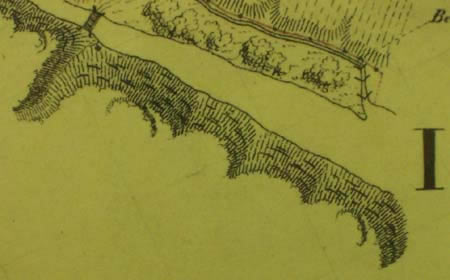
1. At a distance of 12 miles above the head of the tide, which ascends
about 3 miles above the city of Washington, the river is 143 feet
higher than tide water. At that place designated by the name of Great
falls, the boats passing through a canal one mile in length, six
feet deep, and twenty five feet wide, descend 76 feet bv five locks,
100 feet long, and 12 feet wide each, and re-entering the river, follow
its natural bed, eight miles and a half. Another canal of the same
dimensions, and two miles and a half in length, brings them then through
three locks and by a descent of 37 feet to tide water. This last fall
is distinguished by the name of Little falls. The two lower
locks of the Great falls, excavated out of the solid rock, have each
a lift of 18 feet: the three upper locks of solid masonary are of
unequal height, and have together a lift of forty feet. The three
locks of the Little falls, are each one hundred feet in length and
eighteen feet wide. That breadth is unnecessary, and consumes two
much water, a de-
[31]
fect which will be remedied, when stone locks will be substituted
to those now in use, which being Of wood, will soon be decayed.
Three other canals without locks have been opened around three distinct
falls: the principal at the Shenandoe falls below Harper's ferry,
and at the place where the Potomac breaks through the Blue Ridge,
is one mile in length around a fall of fifteen feet. Between this
and the Great falls another canal three quarters of a mile in length,
is opened around the Seneca falls The third, fifty yards in length,
has been cut around Houre's falls, five miles above the Shenandoe
falls. Above this place, the navigation has been improved by deepening
occasionally the channel, raising the water in shallow places by small
dams, and opening sluices along the shore. It is believed that by
multiplying the number of those low dams, by throwing the channel
along the shore, and when necessary opening canals with or without
locks around the principal rapids, the navigation may be improved,
perhaps as high up as Cumberland, 188 miles above tide water, to such
a degree as to render the river passable for boats the greater part
of the year. And if this be found practicable on the Potomac, which
is the most rapid of the great Atlantic rivers, the same improvements
may with greater facility be effected on any of the others. It will
be indispensable, in order to attain that object on the Potomac, that
additional canals with locks, should be openedat the Shenandoe or
Blue Ridge falls, which as has already been stated, fall 43 feet,
in the distance of five miles.
2. The Shenandoe, a river nearly as large as the Potomac itself,
after a course of 250 miles through the Great Limestone valley, unites
its waters with those of the Potomac at Harper's ferry, just above
the Blue Ridge. From Port Republic till within eight miles of the
Potomac, a distance of near 200 miles, it affords a good navigation,
the fall of the river being at the rate of less than two feet a mile.
In the last eight miles it falls eighty feet, and was impassable before
the improvements completed last year by the Potomac company. Six different
canals, 20 feet wide, four feet and a half deep, and extending altogether
2400 yards, have been opened round the most difficult falls. Through
those, and five stone locks, 100 feet long and 12 feet wide each,
and effecting together a descent of near fifty feet, the commuilication
is now opened, and will render the undertaking much more productive
than heretofore. The water in all those canals and locks, as well
as in those executed on the Potomac, is uniformly supplied by the
river itself.
The capital originally subscribed amounted to 311,560 dollars, divided
into 701 shares; of which the state of Maryland owns 220, and the
state of Virginia seventy. The total amount expended, including an
additional payment received from late subscribers, 38,000 dollars
arising from tolls, which have been applied to the work, and a debt
of about 67,000 dollars contracted by the company, amounts to 444,652
dollars. The annual tolls raised on eight thousand tons of sundry
articles, valued at more than half a million of dollars, have not
before the opening of the Shenandoe, exceeded 15,000 dollars; and
the annual expenses and repairs are stated at 5,000 dollars.
One hundred shares of L . 145 sterling each, remain open for
subscription.