|
Reference in C&O Canal Companion: Mile 1 |
|
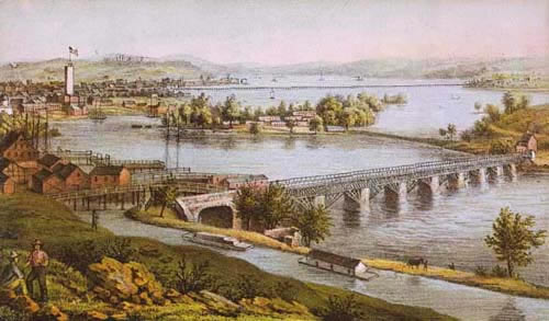
"Aqueduct
of Potomac, Georgetown" |
To be addedMile 1: The government commandeered the aqueduct during the Civil War, draining it and using the bottom of the trough as a road. To protect the aqueduct from Confederate attack, three forts were built on the hill at Rosslyn: Fort Corcoran, Fort Haggerty, and Fort Bennett. Along with several blockhouses, these defenses formed what Union generals termed a tete-a-pont (a fancy French phrase that translates literally to "bridge-head"). After the war, the bridge was turned back over to private ownership, and in 1868 the owners added a toll road on the top. In 1886, the trough of the aqueduct begain leaking and the bridge was closed to traffic. The government eventually persuaded the owners of the Aqueduct Bridge to sell it for $125,000, and the Corps of Engineers replaced the superstructure with an iron-truss road bridge that opened in 1888. (Congress had also authorized an alternative solution -- the construction of a new bridge across Three Sisters Islands, just upstream.) The canal route to Alexandria was no longer necessary, as steam tugboats were being used to propel the canal boats up and down the river from the Tidewater Lock (mile 0). Ironically, Key's house on M Street was later demolished for a ramp of the Whitehurst Freeway that connects to the bridge that bears his name. As a measure of recompense, a small park honoring Key has been opened on M Street, adjacent to the bridge and above the canal. Add to photo caption: Hahn dates this view as 1868, just before the addition of the roadway. Additional NotesThe Aqueduct Bridge: The original aqueduct was begun in 1833, but not completed until ten years later. Major William Turnbull of the Army Topographical Engineers was in charge of the project. The piers were made of gneiss boated down from quarries upstream. The original design was a timber "queen-post" truss construction. The design changed significantly in 1868, when arching Howe trusses were installed. Congress authorized the construction of a replacement bridge in 1916, and work began in 1917. When the Francis Scott Key Bridge was completed in 1923, the Aqueduct Bridge was abandoned, and its superstructure was removed in 1933. The old piers were not removed until 1962, though a portion of the pier nearest the Virginia shore was left as a memento. The defensive works in Rosslyn:
Illustration: One of the blockhouse at Rosslyn, as drawn by Benson Lossing, from the Pictorial Field-book of the Civil War.
|
|
Detail
of a Civil War era photograph of the Aqueduct, with original truss
design, |
|
Detail
of the Aqueduct as it appeared with arch-reinforced trusses |
|
The
former Aqueduct in its final incarnation, |
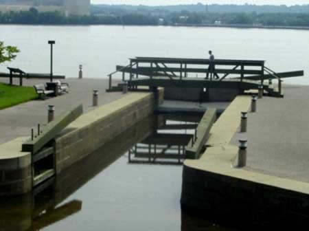
A
restored version of the outlet lock in Alexandria. |
|
Sources:
Also on the Web:
|
 None
of the blockhouses or the three forts in Rosslyn remains, though there
are historical markers for Fort Bennett (outside the Fort Bennett Apartments
on 22nd Street) and Fort Haggerty (intersection of Arlington Ridge Road
and Wilson Road).
None
of the blockhouses or the three forts in Rosslyn remains, though there
are historical markers for Fort Bennett (outside the Fort Bennett Apartments
on 22nd Street) and Fort Haggerty (intersection of Arlington Ridge Road
and Wilson Road).