Notes on John Ballendine
References
in C&O Canal Companion:
Historical Sketch, page 9, Mile 5.6
and "Washington's Canal" inset,
and updates to Miles 42.2 and 69.4.
An
interesting feature of Ballendine's map, as shown in this detail,
is the depiction
of a "Waggon Road 20 miles" connecting the Potomac South
Branch to the
Ohio watershed. Most schemes for a Potomac route across the Appalachians
used the North Branch of the Potomac.
|
|
Further
notes on Ballendines Potomac navigation scheme:
Little
documentary material survives concerning Ballendine's activities in
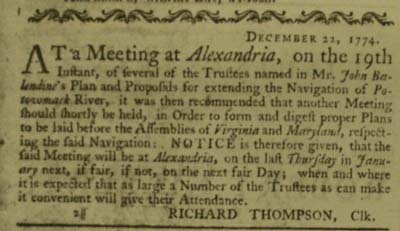
1774-1775. One source is a series of announcements appearing in the
Virginia Gazette, as shown below, and in the Maryland Gazette.
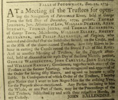
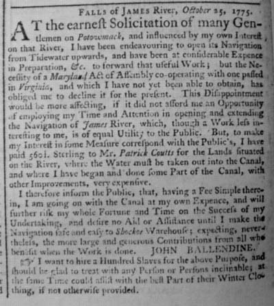
The
second notice contains an impressive array of colonial figures, including
George Washington, Thomas Johnson (soon to become the first governor
of the state of Maryland and owner at various times of furnaces at
Green Springs, Catoctin, and Point of Rocks), and William Deakins
(who owned the furnace property near the Mouth of the Monocacy visited
by George Washington at the beginning of Washington's October 1790
trip to inspect possible locations for the Federal City).
|
|
|
Map
from Geography and Map Division, Library of Congress. The
date the map was drawn is uncertain, but it was likely prepared to
accompany materials promoting the venture that Ballendine distributed
in 1774. The Library of Congress acquired it for $25 in 1934, from
a book dealer in Boston, and it was "rediscovered" by happenstance
in 1963 as the Library was preparing an exhibit on the occasion of
the 100th anniversary of West Virginia's statehood. The map also depicts
Ballendine's proposed connection between the James and Kanawha Rivers,
the forerunner of the James River and Kanawha Canal project.
-
"John
Ballendine's Eighteenth-Century Map of Virginia," by Arther
G. Burton and Richard W. Stephenson, in the Quarterly Journal
of the Library of Congress, July 1964, reprinted in A La
Carte,Selected Papers on Maps and Atlases, Compiled by Walter
W. Ristow, Geography and Map Division, Library of Congress, Washington,
DC, 1972.
-
Early
Chapters in the Development of the Patomac Route to the West,
Mrs. Corra Bacon-Foster, as reprinted from the records of the
Columbia Historical Society. [Originally presented to the Society
on December 14, 1909.]
-
The
notices from the Virginia Gazette, shown above, appeared
in the issues of January 14, 1775, and October 28, 1775. [Note
that the dates for each notice do not correspond tothe issue date]
|