Notes on the Fairfax Survey

References in C&O Canal Companion:
Historical Sketch, pages 2-3


A 
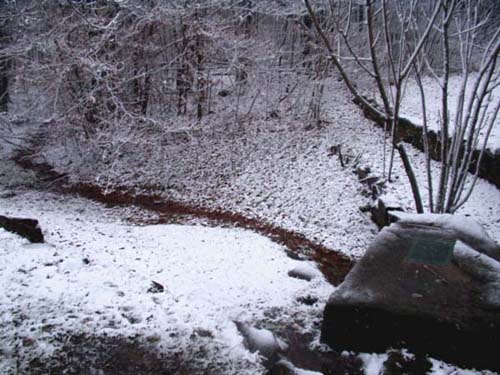
metal plaque and stone mark the first spring of the Potomac,
which bubbles up two miles from the southwest corner of the State of Maryland.
According to John Wayland, the original stone marker was carried off in the late 1800's.
(Photo by M High, December 2002)


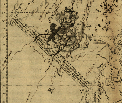
Benjamin Winslow map showing the
headspring of the North Branch of the Potomac River,
from first Fairfax survey, 1736.
(
Library of Congress, Geography & Map Division.)

Detail from digital copy, American Memory collection, Library of Congress


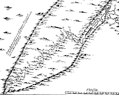
This map detail shows the "Fairfax line" connecting the heads of the North Branch of the Potomac and the South Branch of the Rappahannock River. The surveying party included Joshua Fry and Peter Jefferson (father of Thomas Jefferson), who would later prepare a famous map of the mid-Atlantic region. The party set out on September 19, 1746, first locating the head spring of the south branch of the Rappahannock (the branch now known as Conway River) and then beginning the line from that point. They reached the headspring of the North Branch on October 22nd, where they found the marks left in 1736 by Winslow, Robert Brooke, and Joshua Fry. They reversed direction and reached the head of the Conway on November 13th.


Also see

  • The Virtual Museum of Surveying for a discussion of the Fairfax Line by David Lee Ingram and an account of a 1999 field trip to locate the head of the Conway River.
  • Leeds Castle, birthplace of Thomas, 6th Lord Fairfax.
  • Greenway Court, Fairfax's home along the Blue Ridge.

Sources:

  • Virginia Baron, The Story of Thomas 6th Lord Fairfax, by Stuart E. Brown, Jr.,
    Chesapeake Book Company, Berryville, Virginia, 1965.
  • The Fairfax Line, Thomas Lewis's Journal of 1746, edited by John W. Wayland,
    The Henkel Press, New Market, Virginia, 1925.
  • The Writings of Colonel William Byrd, Edited by John Spencer Bassett,
    Doubleday, Page & Co., New York, 1901
  • The Fairfax Line, A Profile in History and Geography,
    by Charles Morrison, Hagerstown, Maryland, 1970
  • An Outline of the Maryland Boundary Disputes and Related Events,
    by Charles Morrison, Hagerstown, Maryland, 1974
  • The Western Boundary of Maryland, by Charles Morrison,
    McClain Printing Company, Parsons, West Virginia, 1976


| Home | C&O Canal | Historical Sketch | Falls Region | Piedmont and the Sugar Lands | Blue Ridge & Great Valley | The Endless Mountains |   mike.high@lesserscribe.net